Berliner Mauerweg
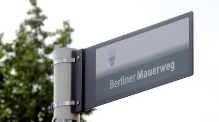
Over 160 kilometers, the Berlin Wall Trail follows the former border strip around West Berlin, divided into 14 stages between Lübars in the north and the Brandenburg countryside. More than a hundred overview maps and forty information stations explain what happened where along the way. Among the Berlin Wall sites, it is the only one you can travel for hours.
Berlin Wall Trail: 160 Kilometers on the Former Border Strip
The Berlin Wall Trail follows the course of the border installations for 160 kilometers, with which the GDR enclosed West Berlin for 155 kilometers. Approximately 45 kilometers of this are on the outskirts and across the city, while the remaining 115 kilometers lead through the Brandenburg countryside along the former outer ring. The route is divided into 14 stages of varying lengths, all connected to public transport. If you only have a free afternoon, choose a stage and start where it suits you best. The path is guided either on the former customs path on the West Berlin side or on the Kolonnenweg (patrol track) used by the border troops in the East.
The State of Berlin had the path laid out between 2002 and 2006 and supplemented between 2008 and 2015. Since 2022, comprehensive improvements have been underway, for which around 12.39 million euros are planned until 2027. Over a hundred overview maps and forty information stations explain what happened at each respective location along the way. A continuous sign indicates the route, so you won’t get lost even without a map.
From Lübars to Friedrichshain: the Highlights of the Route
The northern section near Lübars is part of the 15-kilometer stage from Hermsdorf to Wollankstraße and runs along the Tegeler Fließ and Köppchensee. At Blankenfelder Chaussee, there is a plaque made of two blocks of the border wall. On June 16, 1990, a farmer from Lübars broke through the wall with his tractor there, reopening the connection to Blankenfelde. The spot is still called Checkpoint Qualitz, after the farmer’s name. A little later, a memorial cross on Klemkestraße commemorates Horst Frank, who was shot here on April 28, 1962.
Further south, the Berlin Wall Trail meets the city’s well-known memorial sites. On Bernauer Straße lies the Berlin Wall Memorial, with the only section of the border installations preserved in full depth. In Friedrichshain, the route passes the East Side Gallery, the longest preserved section of the wall in the city. The route is mostly flat and is therefore easy to manage for families and occasional cyclists.

Top10 Redaktion
Erfahrungsbericht vom 22.10.2026
Price Level
The use of the Berlin Wall Trail is free of charge. Various providers offer guided bike tours along the route.
Length and Stages
160 kilometers in 14 stages, of which approx. 45 kilometers are within Berlin city limits and 115 kilometers in Brandenburg.
Public Transport
All stages are connected to public transport. For the Lübars section: S1 to S-Bahn station Hermsdorf, Bus 222 to Alt-Lübars, S-Bahn station Wollankstraße as the endpoint.
Parking
There are no designated parking spaces directly on the path. The best way to reach the individual stages is by train and bus.
Highlight
At Blankenfelder Chaussee, two blocks of the border wall mark Checkpoint Qualitz. On June 16, 1990, a farmer broke through the wall there with his tractor.
Signage
A continuous sign marks the route, complemented by over 100 overview maps and 40 information stations.
Route Profile
Mostly flat and well-developed, making it suitable for families and occasional cyclists.
Opening Hours
- Monday: Open 24 hours
- Tuesday: Open 24 hours
- Wednesday: Open 24 hours
- Thursday: Open 24 hours
- Friday: Open 24 hours
- Saturday: Open 24 hours
- Sunday: Open 24 hours
Address
Berliner Mauerweg 1, 13159 Berlin, Deutschland
http://www.stadtentwicklung.berlin.de/verkehr/mobil/fahrrad/