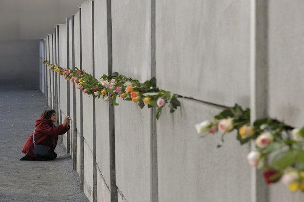
Berliner Mauerweg

The Berlin Wall Trail follows the former border strip around West Berlin for about 160 kilometers, along the patrol road of the GDR border troops and the old customs path. Fourteen sections, between 7 and 21 kilometers long, each begin and end at a train station. Ostalgia takes on a different color here, because on this route, the GDR is not a backdrop, but topography.
Berlin Wall Trail: 160 Kilometers on the former border strip
The Berlin Wall Trail stretches for about 160 kilometers around former West Berlin, about 50 of which run directly through the city and about 110 along the old border to the surrounding area. It largely follows the patrol road, which the GDR border troops created for their control drives, and the customs path on the West Berlin side. Between 2002 and 2006, the route was expanded and signposted, recognizable by white lettering on a gray background and by overview maps at regular intervals.
The Senate Administration has divided the path into fourteen sections, ranging from seven to twenty-one kilometers, each starting and ending at a train station. This allows each stage to be individually reached and left by S-Bahn. Those who want to complete the entire circuit by bike usually plan three to five daily stages. At twenty-nine locations, steles commemorate people who lost their lives at the Wall with short biographies.
From Hermsdorf to Wollankstraße: GDR border history in northern Berlin
Particularly impressive is the fifteen-kilometer section between S-Bahn station Hermsdorf and S-Bahn station Wollankstraße. It leads along Wiesenstraße by the Tegeler Fließ, turns south-southeast before Köppchensee, and then runs through the Lübars recreation park and over the former border strip to Wilhelmsruher Damm. Lübars itself has retained its village character, and the Tegeler Fließ with its moors and lowlands is one of the city’s quietest landscapes.
Amidst all the nature, the traces of division lie close together. On Blankenfelder Chaussee, two border wall segments mark Checkpoint Qualitz, a former wall breach. An information panel near Bahnhofstraße commemorates the Blankenfelde infirmary collection camp, the Soviet Memorial stands in Schönholzer Heide, and on Klemkestraße, a cross commemorates Horst Frank, who was shot at the border in 1962. On the Berlin Wall Trail, the GDR is thus not nostalgically idealized, but becomes comprehensible step by step.

Top10 Redaktion
Erfahrungsbericht vom 27.10.2026
Admission
The Berlin Wall Trail is freely accessible and costs no admission.
Length and Stages
About 160 kilometers, of which approx. 50 kilometers are inner-city. The route is divided into 14 sections of 7 to 21 kilometers.
Signage
Continuously signposted with white lettering on a gray background, plus overview maps at regular intervals.
Memorial
At 29 locations along the route, steles feature short biographies of people who died at the Wall.
Northern Stage
The section from Hermsdorf to Wollankstraße is 15 kilometers long and leads along the Tegeler Fließ and Köppchensee, as well as through the Lübars recreation park.
By Bike
For the complete circuit, one should plan three to five daily stages.
Public Transport
S1 and S85 to Hermsdorf, S1, S25 and S85 to Wollankstraße, Bus 222 to Alt-Lübars.
Opening Hours
- Monday: Open 24 hours
- Tuesday: Open 24 hours
- Wednesday: Open 24 hours
- Thursday: Open 24 hours
- Friday: Open 24 hours
- Saturday: Open 24 hours
- Sunday: Open 24 hours
Address
Berliner Mauerweg, 13159 Berlin, Deutschland